
Barron Gorge National Park topographic map
Interactive map
Click on the map to display elevation.
About this map
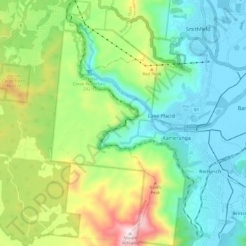
Name: Barron Gorge National Park topographic map, elevation, terrain.
Average elevation: 978 ft
Minimum elevation: 10 ft
Maximum elevation: 3,271 ft
Other topographic maps
Click on a map to view its topography, its elevation and its terrain.
Ellie Point
Australia > Queensland > Cairns
Ellie Point, Aeroglen, Cairns, Cairns Regional, Queensland, Australia
Average elevation: 3 ft