
Azinhaga topographic map
Interactive map
Click on the map to display elevation.
About this map
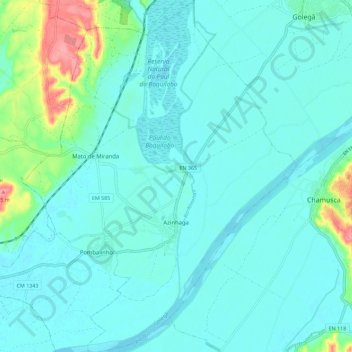
Name: Azinhaga topographic map, elevation, terrain.
Location: Azinhaga, Golegã, Santarém, Portugal (39.31779 -8.57829 39.40586 -8.48850)
Average elevation: 75 ft
Minimum elevation: 26 ft
Maximum elevation: 322 ft