
Gerstenbüttel topographic map
Interactive map
Click on the map to display elevation.
About this map
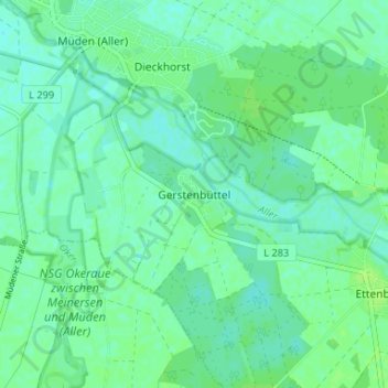
Name: Gerstenbüttel topographic map, elevation, terrain.
Average elevation: 167 ft
Minimum elevation: 151 ft
Maximum elevation: 184 ft
Other topographic maps
Click on a map to view its topography, its elevation and its terrain.
Brome
Allemagne > Basse-Saxe > Gifhorn (arrondissement)
Brome, Samtgemeinde Brome, Gifhorn (arrondissement), Basse-Saxe, 38465, Allemagne
Average elevation: 243 ft
Ehra-Lessien
Allemagne > Basse-Saxe > Gifhorn (arrondissement)
Ehra-Lessien, Samtgemeinde Brome, Gifhorn (arrondissement), Basse-Saxe, 38468, Allemagne
Average elevation: 259 ft