Geolocate

Cirencester topographic map

Click on the map to display elevation.

Cirencester

On Cotswold Avenue is the site of a Roman amphitheatre which, while buried, retains its shape in the earthen topography of the small park setting. Cirencester was one of the most substantial cities of Roman-era Britain.

Wikipedia (CC-BY-SA 3.0)

About this map

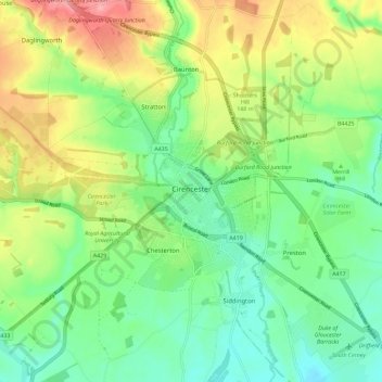
Name: Cirencester topographic map, elevation, terrain.

Location: Cirencester, Chesterton, Cotswold District, Gloucestershire, England, United Kingdom (51.69381 -2.05575 51.73948 -1.94130)

Average elevation: 420 ft

Minimum elevation: 292 ft

Maximum elevation: 636 ft

Gear up for your next adventure:

🪑Portable Camp Table - Compact table for campsite meals
🥾Women's Hiking Boots - Top-rated trail boots with ankle support and superior grip
🔪Outdoor Multitools - Essential survival tools for gear repair and field use
🌲Outdoor Survival Books - Best books on survival skills
🎒Hydration Pack - Hands‑free water reservoir for long hikes

As an Amazon Associate, this site earns from qualifying purchases at no extra cost to you.