Lac de la Taillat topographic map
Interactive map
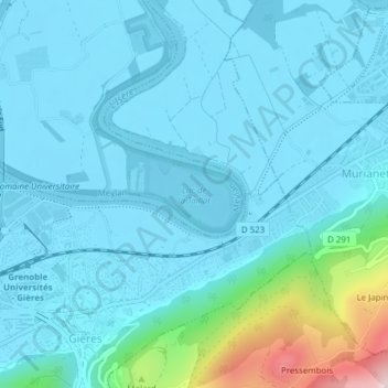
Click on the map to display elevation.
About this map
Name: Lac de la Taillat topographic map, elevation, terrain.
Average elevation: 892 ft
Minimum elevation: 692 ft
Maximum elevation: 2,277 ft

Click on the map to display elevation.
Name: Lac de la Taillat topographic map, elevation, terrain.
Average elevation: 892 ft
Minimum elevation: 692 ft
Maximum elevation: 2,277 ft