
留坝县 topographic map
Interactive map
Click on the map to display elevation.
About this map
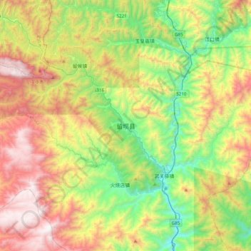
Name: 留坝县 topographic map, elevation, terrain.
Location: 留坝县, 紫柏街道, 留坝县, 汉中市, 陕西省, 中国 (33.45546 106.76141 33.77546 107.08141)
Average elevation: 4,872 ft
Minimum elevation: 2,333 ft
Maximum elevation: 8,632 ft
Other topographic maps
Click on a map to view its topography, its elevation and its terrain.