
Portela das Eiras topographic map
Interactive map
Click on the map to display elevation.
About this map
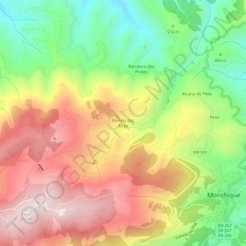
Name: Portela das Eiras topographic map, elevation, terrain.
Location: Portela das Eiras, Monchique, Faro, 8550, Portugal (37.30967 -8.59648 37.34967 -8.55648)
Average elevation: 1,880 ft
Minimum elevation: 853 ft
Maximum elevation: 2,933 ft
Other topographic maps
Click on a map to view its topography, its elevation and its terrain.
Serra de Monchique
Serra de Monchique, Monchique, Faro, Portugal
Average elevation: 1,319 ft