
Cahors topographic map
Interactive map
Click on the map to display elevation.
About this map
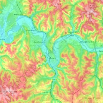
Name: Cahors topographic map, elevation, terrain.
Location: Cahors, Lot, Occitania, Francia metropolitana, 46000, Francia (44.40103 1.37253 44.51213 1.50554)
Average elevation: 679 ft
Minimum elevation: 335 ft
Maximum elevation: 1,125 ft
Other topographic maps
Click on a map to view its topography, its elevation and its terrain.
Revrey
Francia > Occitania > Lot > Saint-Jean-Lespinasse
Revrey, Saint-Jean-Lespinasse, Figeac, Lot, Occitania, Francia metropolitana, 46400, Francia
Average elevation: 692 ft