
Pena Sombreira topographic map
Interactive map
Click on the map to display elevation.
About this map
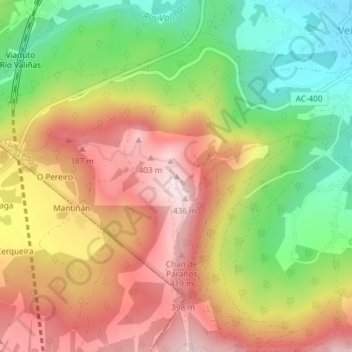
Name: Pena Sombreira topographic map, elevation, terrain.
Location: Pena Sombreira, Culleredo, A Coruña, Galicië, 15198, Spanje (43.24288 -8.43690 43.24298 -8.43680)
Average elevation: 801 ft
Minimum elevation: 151 ft
Maximum elevation: 1,411 ft
Other topographic maps
Click on a map to view its topography, its elevation and its terrain.