
Dzoumogné topographic map
Interactive map
Click on the map to display elevation.
About this map
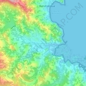
Name: Dzoumogné topographic map, elevation, terrain.
Location: Dzoumogné, Bandraboua, Mayotte, 97650, France (-12.74187 45.10027 -12.70187 45.14027)
Average elevation: 184 ft
Minimum elevation: 0 ft
Maximum elevation: 722 ft