
Werther (Westf.) topographic map
Interactive map
Click on the map to display elevation.
About this map
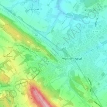
Name: Werther (Westf.) topographic map, elevation, terrain.
Average elevation: 528 ft
Minimum elevation: 358 ft
Maximum elevation: 955 ft
Werther liegt am Nordhang des Teutoburger Waldes. Der Höhenzug ist an dieser Stelle Teil der Weser-Ems-Wasserscheide.