Geolocate

Pearsall topographic map

Click on the map to display elevation.

About this map
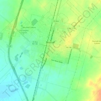
Name: Pearsall topographic map, elevation, terrain.

Location: Pearsall, Frio County, Texas, United States (28.86498 -99.12642 28.91176 -99.07276)

Average elevation: 627 ft

Minimum elevation: 571 ft

Maximum elevation: 702 ft

Frio County trails, hiking, mountain biking, running and outdoor activities

Other topographic maps

Click on a map to view its topography, its elevation and its terrain.

Moore

United States > Texas > Frio County

Average elevation: 673 ft

Gear up for your next adventure:

📖Nature Tracking Books - Learn to track wildlife and terrain
🌧️Backpack Rain Cover - Keep gear dry in wet weather
🔦LED Headlamp - Bright and durable LED headlamp for night navigation
🔥Plasma Lighters - Windproof lighters that work in any weather condition
🥾Hiking Shoes - Durable and comfortable shoes for trail hiking

As an Amazon Associate, this site earns from qualifying purchases at no extra cost to you.