Geolocate

Elden topographic map

Click on the map to display elevation.

About this map

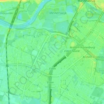
Name: Elden topographic map, elevation, terrain.

Location: Elden, Arnhem, Gelderland, Netherlands, 6842 AT, Netherlands (51.93820 5.86330 51.97820 5.90330)

Average elevation: 36 ft

Minimum elevation: 10 ft

Maximum elevation: 69 ft

Gear up for your next adventure:

📶Satellite Messenger - Communication device off‑grid
📱Heavy-Duty Phone Cases - Drop-proof and waterproof protection for outdoor navigation
🛰️Handheld GPS Units - Professional satellite navigators for precise backcountry mapping
🎒Outdoor Daypacks - Lightweight backpacks designed for carrying maps and essential gear
🦶Hiking Gaiters - Keep debris and water out of your boots

As an Amazon Associate, this site earns from qualifying purchases at no extra cost to you.