
Kirchdorf an der Krems topographic map
Interactive map
Click on the map to display elevation.
About this map
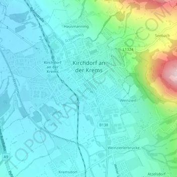
Name: Kirchdorf an der Krems topographic map, elevation, terrain.
Average elevation: 1,558 ft
Minimum elevation: 1,358 ft
Maximum elevation: 2,451 ft
Other topographic maps
Click on a map to view its topography, its elevation and its terrain.
Schloss Klaus
Austria > Upper Austria > Bezirk Kirchdorf > Klaus an der Pyhrnbahn
Schloss Klaus, 16, Klaus an der Pyhrnbahn, Bezirk Kirchdorf, Upper Austria, 4564, Austria
Average elevation: 2,221 ft