
Thank you for supporting this site ❤️
Make a donation
Make a donation
Gear up for your next adventure:
As an Amazon Associate, this site earns from qualifying purchases at no extra cost to you.
Herndon topographic map
Click on the map to display elevation.
Thank you for supporting this site ❤️
Make a donation
Make a donation
Gear up for your next adventure:
As an Amazon Associate, this site earns from qualifying purchases at no extra cost to you.
About this map
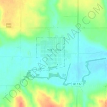
Name: Herndon topographic map, elevation, terrain.
Location: Herndon, Rawlins County, Kansas, 67739, United States (39.90453 -100.79080 39.91287 -100.78158)
Average elevation: 2,710 ft
Minimum elevation: 2,651 ft
Maximum elevation: 2,822 ft
Rawlins County trails, hiking, mountain biking, running and outdoor activities
Thank you for supporting this site ❤️
Make a donation
Make a donation
Gear up for your next adventure:
As an Amazon Associate, this site earns from qualifying purchases at no extra cost to you.