
Emory topographic map
Interactive map
Click on the map to display elevation.
About this map
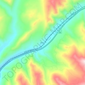
Name: Emory topographic map, elevation, terrain.
Location: Emory, Summit County, Utah, 84024, États-Unis d'Amérique (41.02900 -111.32488 41.06900 -111.28488)
Average elevation: 6,411 ft
Minimum elevation: 5,850 ft
Maximum elevation: 7,280 ft