
Quiroga topographic map
Interactive map
Click on the map to display elevation.
About this map
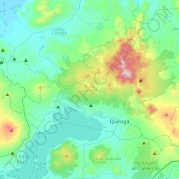
Name: Quiroga topographic map, elevation, terrain.
Location: Quiroga, Michoacán, Mexique (19.63716 -101.66869 19.77828 -101.40266)
Average elevation: 7,375 ft
Minimum elevation: 6,503 ft
Maximum elevation: 10,801 ft