
Oedenburg topographic map
Interactive map
Click on the map to display elevation.
About this map
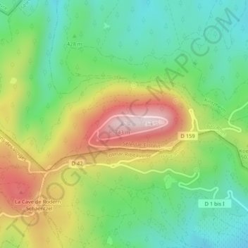
Name: Oedenburg topographic map, elevation, terrain.
Average elevation: 1,509 ft
Minimum elevation: 951 ft
Maximum elevation: 2,379 ft
Other topographic maps
Click on a map to view its topography, its elevation and its terrain.
Hohkönigsburg
Frankreich > Großer Osten > Unterelsass > Orschweiler
Hohkönigsburg, D 159, Château du Haut-Kœnigsbourg, Orschweiler, Schlettstadt-Erstein, Unterelsass, Großer Osten, Metropolitanes Frankreich, 67600, Frankreich
Average elevation: 1,447 ft