
Thank you for supporting this site ❤️
Make a donation
Make a donation
Gear up for your next adventure:
As an Amazon Associate, this site earns from qualifying purchases at no extra cost to you.
Tassoust topographic map
Click on the map to display elevation.
Thank you for supporting this site ❤️
Make a donation
Make a donation
Gear up for your next adventure:
As an Amazon Associate, this site earns from qualifying purchases at no extra cost to you.
About this map
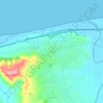
Name: Tassoust topographic map, elevation, terrain.
Location: Tassoust, Emir Abdelkader, Taher District, Jijel, 18038, Algeria (36.78211 5.82260 36.82211 5.86260)
Average elevation: 75 ft
Minimum elevation: -7 ft
Maximum elevation: 469 ft
Thank you for supporting this site ❤️
Make a donation
Make a donation
Gear up for your next adventure:
As an Amazon Associate, this site earns from qualifying purchases at no extra cost to you.