Geolocate

West topographic map

Click on the map to display elevation.

About this map

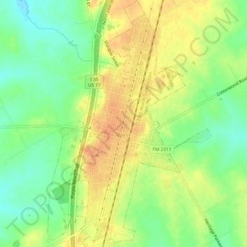
Name: West topographic map, elevation, terrain.

Location: West, McLennan County, Texas, 14673, United States (31.78610 -97.10720 31.82434 -97.07731)

Average elevation: 610 ft

Minimum elevation: 541 ft

Maximum elevation: 673 ft

McLennan County trails, hiking, mountain biking, running and outdoor activities

Other topographic maps

Click on a map to view its topography, its elevation and its terrain.

Elm Mott

United States > Texas > McLennan County

Average elevation: 512 ft

Hewitt

United States > Texas > McLennan County > Hewitt > Hewitt

Average elevation: 620 ft

Bruceville-Eddy

United States > Texas > McLennan County

Average elevation: 650 ft

Waco

United States > Texas > McLennan County > Waco

Average elevation: 492 ft

Gear up for your next adventure:

🔌USB Car Charger - Car charger for on‑the‑go power needs
⛑️Personal Locator Beacon - Safety beacon for emergencies
🧭Hiking Compass - Precision compass for reliable navigation in the wilderness
🔦LED Headlamp - Bright and durable LED headlamp for night navigation
🗺️Topographic Maps - Detailed topo maps for hiking, exploring and outdoor navigation

As an Amazon Associate, this site earns from qualifying purchases at no extra cost to you.