
Zetel topographic map
Interactive map
Click on the map to display elevation.
About this map
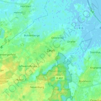
Name: Zetel topographic map, elevation, terrain.
Location: Zetel, Landkreis Friesland, Niedersachsen, 26340, Deutschland (53.37592 7.93048 53.45592 8.01048)
Average elevation: 16 ft
Minimum elevation: -10 ft
Maximum elevation: 56 ft