
Thank you for supporting this site ❤️
Make a donation
Make a donation
Gear up for your next adventure:
As an Amazon Associate, this site earns from qualifying purchases at no extra cost to you.
Lupiana topographic map
Click on the map to display elevation.
Thank you for supporting this site ❤️
Make a donation
Make a donation
Gear up for your next adventure:
As an Amazon Associate, this site earns from qualifying purchases at no extra cost to you.
About this map
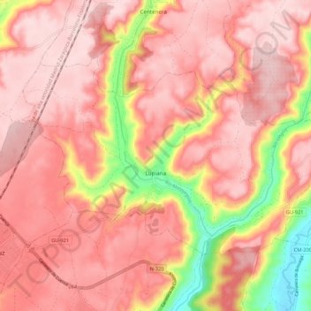
Name: Lupiana topographic map, elevation, terrain.
Location: Lupiana, Guadalajara, Castile-La Mancha, 19142, Spain (40.58924 -3.09925 40.64055 -2.99261)
Average elevation: 2,930 ft
Minimum elevation: 2,323 ft
Maximum elevation: 3,182 ft
Thank you for supporting this site ❤️
Make a donation
Make a donation
Gear up for your next adventure:
As an Amazon Associate, this site earns from qualifying purchases at no extra cost to you.