
Rivière de la Grande Vallée topographic map
Interactive map
Click on the map to display elevation.
About this map
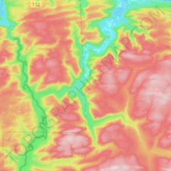
Name: Rivière de la Grande Vallée topographic map, elevation, terrain.
Average elevation: 938 ft
Minimum elevation: -7 ft
Maximum elevation: 1,778 ft
Other topographic maps
Click on a map to view its topography, its elevation and its terrain.
Lac Mercier
Canada > Québec > La Haute-Gaspésie > Sainte-Madeleine-de-la-Rivière-Madeleine
Lac Mercier, Sainte-Madeleine-de-la-Rivière-Madeleine, La Haute-Gaspésie, Gaspésie–Îles-de-la-Madeleine, Québec, Canada
Average elevation: 1,175 ft