
Victoria Station topographic map
Interactive map
Click on the map to display elevation.
About this map
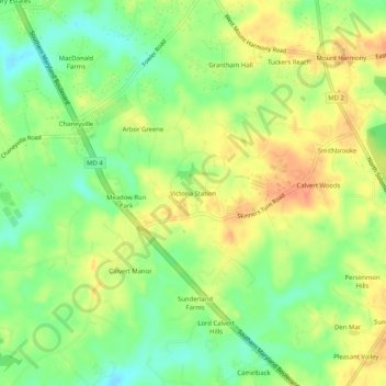
Name: Victoria Station topographic map, elevation, terrain.
Location: Victoria Station, Calvert County, Maryland, 20736, USA (38.66456 -76.64441 38.70456 -76.60441)
Average elevation: 125 ft
Minimum elevation: 46 ft
Maximum elevation: 197 ft