
Whaley Bridge topographic map
Interactive map
Click on the map to display elevation.
About this map
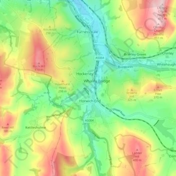
Name: Whaley Bridge topographic map, elevation, terrain.
Location: Whaley Bridge, High Peak, Derbyshire, England, United Kingdom (53.29752 -2.01432 53.35772 -1.96001)
Average elevation: 873 ft
Minimum elevation: 449 ft
Maximum elevation: 1,493 ft