
Westdorf topographic map
Interactive map
Click on the map to display elevation.
About this map
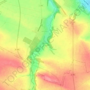
Name: Westdorf topographic map, elevation, terrain.
Average elevation: 531 ft
Minimum elevation: 351 ft
Maximum elevation: 650 ft
Other topographic maps
Click on a map to view its topography, its elevation and its terrain.
Schackenthal
Deutschland > Sachsen-Anhalt > Salzlandkreis > Aschersleben
Schackenthal, Aschersleben, Salzlandkreis, Sachsen-Anhalt, Deutschland
Average elevation: 449 ft
Mehringen
Deutschland > Sachsen-Anhalt > Salzlandkreis > Aschersleben
Mehringen, Aschersleben, Salzlandkreis, Sachsen-Anhalt, Deutschland
Average elevation: 456 ft