
Moulin topographic map
Interactive map
Click on the map to display elevation.
About this map
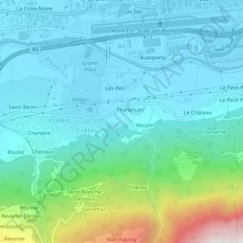
Name: Moulin topographic map, elevation, terrain.
Location: Moulin, Tharençan, Crêtes, Pollein, Vallée d'Aoste, Italie (45.72214 7.35830 45.73356 7.37364)
Average elevation: 2,444 ft
Minimum elevation: 1,755 ft
Maximum elevation: 5,367 ft