Geolocate

Lalín topographic map

Click on the map to display elevation.

About this map

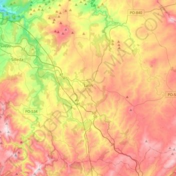
Name: Lalín topographic map, elevation, terrain.

Location: Lalín, O Deza, Pontevedra, Galicia, Spain (42.53386 -8.26469 42.78103 -7.98823)

Average elevation: 1,886 ft

Minimum elevation: 358 ft

Maximum elevation: 3,291 ft

Other topographic maps

Click on a map to view its topography, its elevation and its terrain.

Vila de Cruces

Spain > Galicia > O Deza

Average elevation: 1,483 ft

Agolada

Spain > Galicia > O Deza

Average elevation: 1,867 ft

Gear up for your next adventure:

🪶Camp Gear Gift Set - Perfect gift bundle for outdoor fans
🧷Carabiner Set - Durable clips for gear attachment
⛑️Personal Locator Beacon - Safety beacon for emergencies
📶Satellite Messenger - Communication device off‑grid
🕶️GPS Smartphone Mount - Secure mount for phone navigation

As an Amazon Associate, this site earns from qualifying purchases at no extra cost to you.