Col de Joux Plane topographic map
Interactive map
Click on the map to display elevation.
About this map
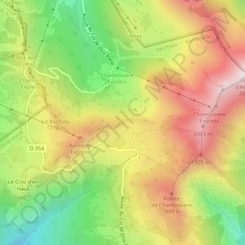
Name: Col de Joux Plane topographic map, elevation, terrain.
Average elevation: 5,397 ft
Minimum elevation: 3,990 ft
Maximum elevation: 6,791 ft

Click on the map to display elevation.
Name: Col de Joux Plane topographic map, elevation, terrain.
Average elevation: 5,397 ft
Minimum elevation: 3,990 ft
Maximum elevation: 6,791 ft