
Cañón de Almadenes topographic map
Interactive map
Click on the map to display elevation.
About this map
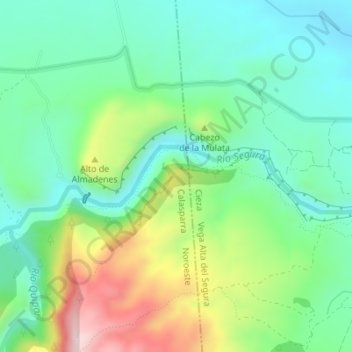
Name: Cañón de Almadenes topographic map, elevation, terrain.
Location: Cañón de Almadenes, Calasparra, Noroeste, España (38.22988 -1.59198 38.24988 -1.57198)
Average elevation: 1,076 ft
Minimum elevation: 696 ft
Maximum elevation: 1,909 ft
Other topographic maps
Click on a map to view its topography, its elevation and its terrain.
Embalse de Alfonso XIII
España > Noroeste > Calasparra
Embalse de Alfonso XIII, Calasparra, Noroeste, España
Average elevation: 1,119 ft