
Thank you for supporting this site ❤️
Make a donation
Make a donation
Gear up for your next adventure:
As an Amazon Associate, this site earns from qualifying purchases at no extra cost to you.
Lippstadt topographic map
Click on the map to display elevation.
Thank you for supporting this site ❤️
Make a donation
Make a donation
Gear up for your next adventure:
As an Amazon Associate, this site earns from qualifying purchases at no extra cost to you.
About this map
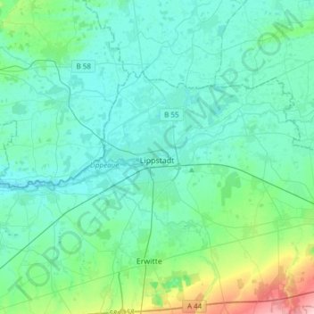
Name: Lippstadt topographic map, elevation, terrain.
Location: Lippstadt, Kreis Soest, North Rhine-Westphalia, Germany (51.62526 8.18275 51.72778 8.48506)
Average elevation: 308 ft
Minimum elevation: 226 ft
Maximum elevation: 758 ft
Thank you for supporting this site ❤️
Make a donation
Make a donation
Gear up for your next adventure:
As an Amazon Associate, this site earns from qualifying purchases at no extra cost to you.