
Boucan-Canot topographic map
Interactive map
Click on the map to display elevation.
About this map
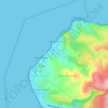
Name: Boucan-Canot topographic map, elevation, terrain.
Location: Boucan-Canot, Saint-Paul, La Réunion, 97434, France (-21.05098 55.20656 -21.01098 55.24656)
Average elevation: 135 ft
Minimum elevation: 0 ft
Maximum elevation: 712 ft