
Urko topographic map
Interactive map
Click on the map to display elevation.
About this map
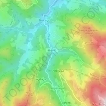
Name: Urko topographic map, elevation, terrain.
Location: Urko, Marquina-Jeméin, Vizcaya, País Vasco, 48270, España (43.22854 -2.48944 43.22869 -2.48940)
Average elevation: 1,070 ft
Minimum elevation: 394 ft
Maximum elevation: 2,218 ft
Other topographic maps
Click on a map to view its topography, its elevation and its terrain.
Marquina-Jeméin
España > País Vasco > Marquina-Jeméin
Marquina-Jeméin, Vizcaya, País Vasco, 48270, España
Average elevation: 951 ft