
Weyer topographic map
Interactive map
Click on the map to display elevation.
About this map
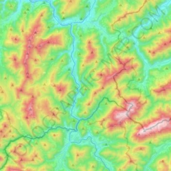
Name: Weyer topographic map, elevation, terrain.
Location: Weyer, Bezirk Steyr-Land, 3335, Oostenrijk (47.67821 14.46032 47.88017 14.74636)
Average elevation: 2,671 ft
Minimum elevation: 1,224 ft
Maximum elevation: 5,679 ft