Geolocate

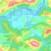
Cuadonga / Covadonga topographic map

Click on the map to display elevation.

About this map

Name: Cuadonga / Covadonga topographic map, elevation, terrain.

Location: Cuadonga / Covadonga, Cangas de Onís, Asturias, Spain (43.29124 -5.07544 43.31739 -5.04461)

Average elevation: 1,650 ft

Minimum elevation: 453 ft

Maximum elevation: 2,684 ft

Other topographic maps

Click on a map to view its topography, its elevation and its terrain.

Miyar

Spain > Asturias > Cangas de Onís

Average elevation: 509 ft

Pan de Carmen

Spain > Asturias > Cangas de Onís

Average elevation: 3,668 ft

Lagos de Covadonga

Spain > Asturias > Cangas de Onís

Average elevation: 3,681 ft

Cuadonga / Covadonga

Spain > Asturias > Cangas de Onís

Average elevation: 1,654 ft

Peruyes

Spain > Asturias > Cangas de Onís

Average elevation: 502 ft

Gear up for your next adventure:

🗺️Topographic Maps - Detailed topo maps for hiking, exploring and outdoor navigation
🎒Outdoor Daypacks - Lightweight backpacks designed for carrying maps and essential gear
❄️Traction Cleats - Prevent slips on icy trails during winter hikes
👟Men's Trail Runners - Lightweight footwear for fast-paced exploration and light hiking
🥩Freeze-Dried Meals - Nutritious and lightweight food for remote expeditions

As an Amazon Associate, this site earns from qualifying purchases at no extra cost to you.