
Kúty topographic map
Interactive map
Click on the map to display elevation.
About this map
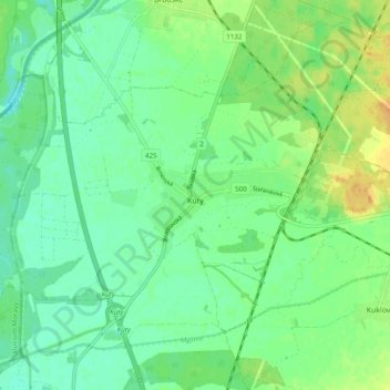
Name: Kúty topographic map, elevation, terrain.
Average elevation: 518 ft
Minimum elevation: 479 ft
Maximum elevation: 581 ft
The municipality lies at an altitude of 156 metres and covers an area of 27.158 km2. It has a population of about 4,006 people.
Other topographic maps
Click on a map to view its topography, its elevation and its terrain.
Senica
Slovakia > Region of Trnava > District of Senica > Senica
Senica, District of Senica, Region of Trnava, Western Slovakia, Slovakia
Average elevation: 738 ft
Kúty
Slovakia > Region of Trnava > District of Senica > Kúty > Kúty
Kúty, District of Senica, Region of Trnava, Western Slovakia, 908 01, Slovakia
Average elevation: 515 ft