
Chopra topographic map
Interactive map
Click on the map to display elevation.
About this map
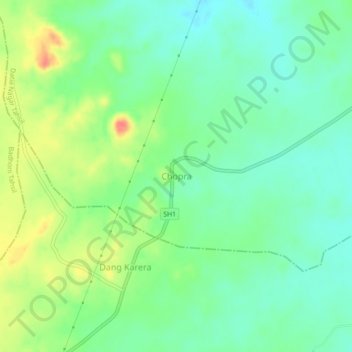
Name: Chopra topographic map, elevation, terrain.
Location: Chopra, Datia Nagar Tahsil, Datia, Madhya Pradesh, India (25.58922 78.38138 25.62922 78.42138)
Average elevation: 850 ft
Minimum elevation: 784 ft
Maximum elevation: 968 ft
Other topographic maps
Click on a map to view its topography, its elevation and its terrain.
Sirol
India > Madhya Pradesh > Datia Nagar Tahsil
Sirol, Datia Nagar Tahsil, Datia, Madhya Pradesh, 475661, India
Average elevation: 709 ft