
Ouled Antar topographic map
Interactive map
Click on the map to display elevation.
About this map
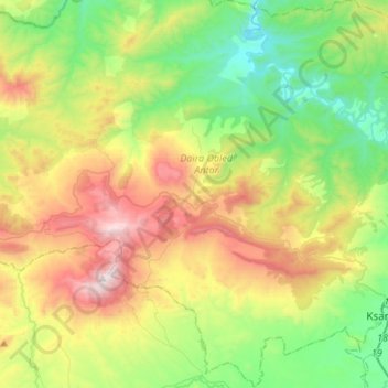
Name: Ouled Antar topographic map, elevation, terrain.
Location: Ouled Antar, Daïra Ouled Antar, Médéa, Algérie (35.84601 2.54108 36.06453 2.79166)
Average elevation: 2,956 ft
Minimum elevation: 1,486 ft
Maximum elevation: 5,568 ft
Other topographic maps
Click on a map to view its topography, its elevation and its terrain.
Boghar
Algérie > Médéa > Daïra Ouled Antar
Boghar, Daïra Ouled Antar, Médéa, Algérie
Average elevation: 2,546 ft