
Thank you for supporting this site ❤️
Make a donation
Make a donation
Gear up for your next adventure:
As an Amazon Associate, this site earns from qualifying purchases at no extra cost to you.
Dégioz topographic map
Click on the map to display elevation.
Thank you for supporting this site ❤️
Make a donation
Make a donation
Gear up for your next adventure:
As an Amazon Associate, this site earns from qualifying purchases at no extra cost to you.
About this map
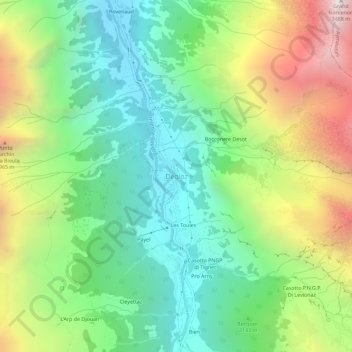
Name: Dégioz topographic map, elevation, terrain.
Location: Dégioz, Valsavarenche, Aosta Valley, Italy (45.57181 7.18984 45.61181 7.22984)
Average elevation: 7,133 ft
Minimum elevation: 4,767 ft
Maximum elevation: 11,394 ft
Thank you for supporting this site ❤️
Make a donation
Make a donation
Gear up for your next adventure:
As an Amazon Associate, this site earns from qualifying purchases at no extra cost to you.