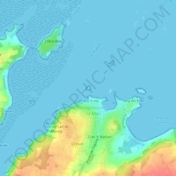
Roc'h Hir topographic map
Interactive map
Click on the map to display elevation.
About this map
Name: Roc'h Hir topographic map, elevation, terrain.
Average elevation: 33 ft
Minimum elevation: -3 ft
Maximum elevation: 203 ft

Click on the map to display elevation.
Name: Roc'h Hir topographic map, elevation, terrain.
Average elevation: 33 ft
Minimum elevation: -3 ft
Maximum elevation: 203 ft