Geolocate

Cabanas topographic map

Click on the map to display elevation.

About this map
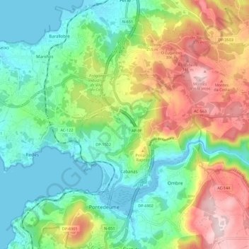
Name: Cabanas topographic map, elevation, terrain.

Location: Cabanas, O Eume, A Coruña, Galicia, Spain (43.40549 -8.18569 43.46198 -8.07558)

Average elevation: 669 ft

Minimum elevation: -3 ft

Maximum elevation: 1,555 ft

Other topographic maps

Click on a map to view its topography, its elevation and its terrain.

Abercovo

Spain > Galicia > O Eume > Monfero

Average elevation: 791 ft

O Xestal

Spain > Galicia > O Eume

Average elevation: 1,152 ft

Gear up for your next adventure:

🎒Waterproof Dry Bags - Keep your electronics and maps dry inside your pack
🪶Camp Gear Gift Set - Perfect gift bundle for outdoor fans
🩹Survival Bandages - High‑quality bandages for emergencies
🚪Portable Camp Chair - Foldable chair for comfort at camp
🎒Hydration Pack - Hands‑free water reservoir for long hikes

As an Amazon Associate, this site earns from qualifying purchases at no extra cost to you.