
龙兴街道 topographic map
Interactive map
Click on the map to display elevation.
About this map
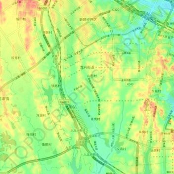
Name: 龙兴街道 topographic map, elevation, terrain.
Location: 龙兴街道, Honggutan District, Nanchang, Jiangxi, China (28.55499 115.70279 28.64445 115.76770)
Average elevation: 144 ft
Minimum elevation: 59 ft
Maximum elevation: 243 ft
Other topographic maps
Click on a map to view its topography, its elevation and its terrain.
长埇许家村
China > Jiangxi > Honggutan District > 长桶村
长埇许家村, 红角洲街道, 长桶村, Honggutan District, Nanchang, Jiangxi, 330063, China
Average elevation: 98 ft