
Copalnic-Mănăștur topographic map
Interactive map
Click on the map to display elevation.
About this map
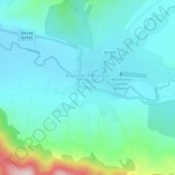
Name: Copalnic-Mănăștur topographic map, elevation, terrain.
Location: Copalnic-Mănăștur, Maramureș, 437100, Romania (47.49804 23.67038 47.51634 23.69008)
Average elevation: 978 ft
Minimum elevation: 774 ft
Maximum elevation: 1,919 ft
Other topographic maps
Click on a map to view its topography, its elevation and its terrain.