
杨滩镇 topographic map
Interactive map
Click on the map to display elevation.
About this map
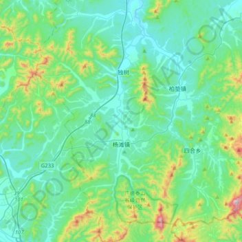
Name: 杨滩镇 topographic map, elevation, terrain.
Location: 杨滩镇, 广德市, 宣城市, 安徽省, 中国 (30.59654 119.05685 30.86743 119.23854)
Average elevation: 581 ft
Minimum elevation: 102 ft
Maximum elevation: 2,680 ft