
Pine Grove Pond topographic map
Interactive map
Click on the map to display elevation.
About this map
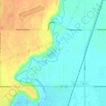
Name: Pine Grove Pond topographic map, elevation, terrain.
Average elevation: 2,966 ft
Minimum elevation: 2,917 ft
Maximum elevation: 3,048 ft
Other topographic maps
Click on a map to view its topography, its elevation and its terrain.
Glacier Bay
États-Unis d'Amérique > Montana > Flathead County
Glacier Bay, Flathead County, Montana, États-Unis d'Amérique
Average elevation: 2,979 ft