
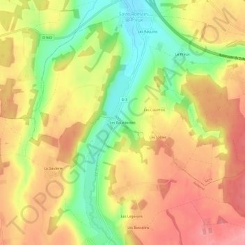
Les Bourderons topographic map
Interactive map
Click on the map to display elevation.
About this map
Name: Les Bourderons topographic map, elevation, terrain.
Average elevation: 577 ft
Minimum elevation: 397 ft
Maximum elevation: 712 ft
Other topographic maps
Click on a map to view its topography, its elevation and its terrain.
Les Pillards
France > Bourgogne-Franche-Comté > Yonne > Sépeaux-Saint Romain
Les Pillards, Sépeaux, Sépeaux-Saint Romain, Sens, Yonne, Bourgogne-Franche-Comté, France métropolitaine, 89116, France
Average elevation: 515 ft
Les Trouvés
France > Bourgogne-Franche-Comté > Yonne > Sépeaux-Saint Romain
Les Trouvés, Sépeaux, Sépeaux-Saint Romain, Sens, Yonne, Bourgogne-Franche-Comté, France métropolitaine, 89116, France
Average elevation: 512 ft