
Khardaha topographic map
Interactive map
Click on the map to display elevation.
About this map
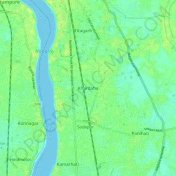
Name: Khardaha topographic map, elevation, terrain.
Average elevation: 23 ft
Minimum elevation: -10 ft
Maximum elevation: 49 ft
Khardaha is located at 22°43′N 88°23′E / 22.72°N 88.38°E / 22.72; 88.38.[4] It has an average elevation of 15 m (49 ft). It has a railway station on the Sealdah-Ranaghat section, sandwiched between Sodepur and Sukchar (to the south) and Titagarh (to the north). The railway station divides the town into two parts - the eastern part is known as Rahara, while the western part is known as Khardaha.
Other topographic maps
Click on a map to view its topography, its elevation and its terrain.
Kamarhati
India > West Bengal > Barrackpur - II
Kamarhati, Barrackpur - II, North 24 Parganas, West Bengal, 700058, India
Average elevation: 20 ft