
Make a donation
Gear up for your next adventure:
As an Amazon Associate, this site earns from qualifying purchases at no extra cost to you.
Staythorpe CP topographic map
Click on the map to display elevation.
Make a donation
Gear up for your next adventure:
As an Amazon Associate, this site earns from qualifying purchases at no extra cost to you.
Staythorpe CP
The land is very low-lying and level, varying little in elevation between 12–14 metres (39–46 ft) throughout.
Make a donation
Gear up for your next adventure:
As an Amazon Associate, this site earns from qualifying purchases at no extra cost to you.
About this map
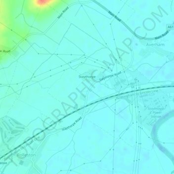
Name: Staythorpe CP topographic map, elevation, terrain.
Average elevation: 52 ft
Minimum elevation: 30 ft
Maximum elevation: 190 ft
Make a donation
Gear up for your next adventure:
As an Amazon Associate, this site earns from qualifying purchases at no extra cost to you.
Other topographic maps
Click on a map to view its topography, its elevation and its terrain.
Newark on Trent
United Kingdom > England > Nottinghamshire > Newark and Sherwood
Average elevation: 59 ft