
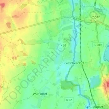
Gleschendorf topographic map
Interactive map
Click on the map to display elevation.
About this map
Name: Gleschendorf topographic map, elevation, terrain.
Average elevation: 98 ft
Minimum elevation: 36 ft
Maximum elevation: 194 ft
Other topographic maps
Click on a map to view its topography, its elevation and its terrain.
Kattenhöhlen
Deutschland > Schleswig-Holstein > Ostholstein > Scharbeutz
Kattenhöhlen, Scharbeutz, Ostholstein, Schleswig-Holstein, 23683, Deutschland
Average elevation: 59 ft
Scharbeutz
Deutschland > Schleswig-Holstein > Ostholstein > Scharbeutz
Scharbeutz, Ostholstein, Schleswig-Holstein, 23683, Deutschland
Average elevation: 46 ft
Haffkrug
Deutschland > Schleswig-Holstein > Ostholstein > Scharbeutz
Haffkrug, Scharbeutz, Ostholstein, Schleswig-Holstein, Deutschland
Average elevation: 30 ft