
Sidi El Heni topographic map
Interactive map
Click on the map to display elevation.
About this map
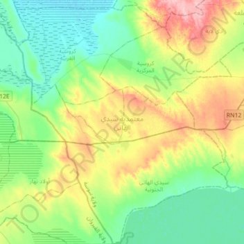
Name: Sidi El Heni topographic map, elevation, terrain.
Location: Sidi El Heni, Sousse, Tunisie (35.58439 10.19780 35.81393 10.44564)
Average elevation: 197 ft
Minimum elevation: 56 ft
Maximum elevation: 499 ft
Other topographic maps
Click on a map to view its topography, its elevation and its terrain.